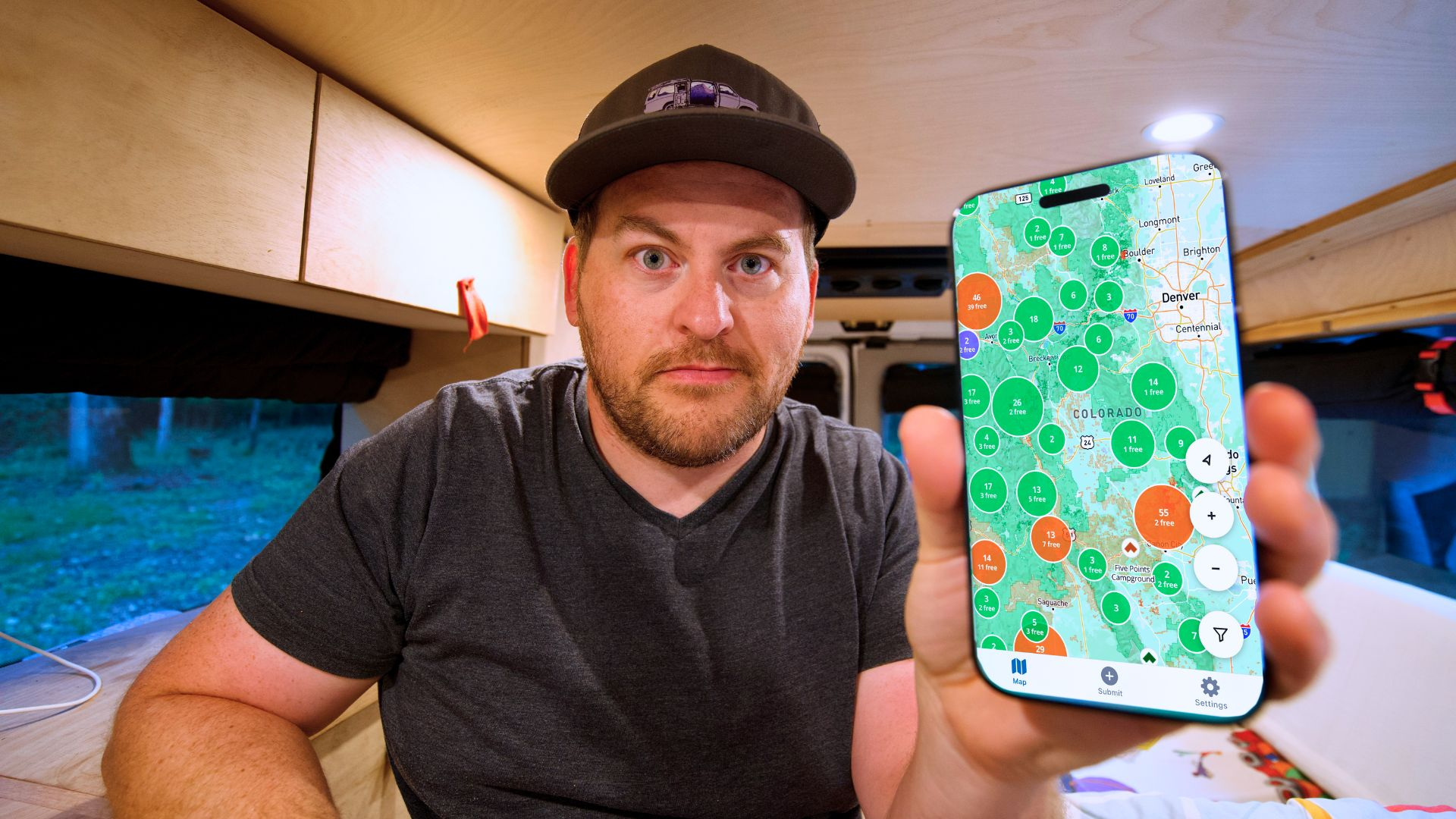
Finding quality camping on public lands shouldn't require hours of research. Dispersed makes it simple with comprehensive USFS, BLM, and NPS campground data, community reviews, GPS coordinates, and premium Hidden Gems from real campers.
Hey Product Hunt! I'm excited to share Dispersed with you today.
THE PROBLEM
I run a camping YouTube channel exploring public lands across America. I was spending $40-60/night at campgrounds when thousands of free spots existed on USFS and BLM lands - but finding them was a nightmare. Hours jumping between government websites, outdated forums, and incomplete apps.
I'd show up to find "No Camping" signs or closed roads. There had to be a better way.
THE SOLUTION
As a developer, I built Dispersed - pulling data directly from USFS, BLM, and National Park Service sources to create the most complete public lands camping database available.
WHAT MAKES IT DIFFERENT
Official Sites Free Forever: All official sites and campgrounds from government sources are free forever, period. Data-Centric: Official geodatabase sources, not crowdsourced guesses. Most apps miss 70-80% of campgrounds. Validated Public Land: Every site verified on confirmed public land using official land boundary sources and spatial analysis. No accidental trespassing. Verified Submissions: We verify every user submission. Submitted campsites are a premium only feature, so everyone has skin in the game to keep the quality high. Better UX: Built mobile-first for field conditions. Offline maps, satellite imagery, works without cell service. Real Reviews: Community Check Ins with photos from actual campers.
LAUNCH SPECIAL Submit 5 qualified campsites: FREE Premium for a year!
Built for budget campers, van lifers, weekend warriors, overlanders and anyone who believes outdoor adventures shouldn't cost a fortune.

 Casey Kinsey
Hey Product Hunt! I'm excited to share Dispersed with you today.
THE PROBLEM
I run a camping YouTube channel exploring public lands across America. I was spending $40-60/night at campgrounds when thousands of free spots existed on USFS and BLM lands - but finding them was a nightmare. Hours jumping between government websites, outdated forums, and incomplete apps.
I'd show up to find "No Camping" signs or closed roads. There had to be a better way.
THE SOLUTION
As a developer, I built Dispersed - pulling data directly from USFS, BLM, and National Park Service sources to create the most complete public lands camping database available.
WHAT MAKES IT DIFFERENT
Official Sites Free Forever: All official sites and campgrounds from government sources are free forever, period.
Data-Centric: Official geodatabase sources, not crowdsourced guesses. Most apps miss 70-80% of campgrounds.
Validated Public Land: Every site verified on confirmed public land using official land boundary sources and spatial analysis. No accidental trespassing.
Verified Submissions: We verify every user submission. Submitted campsites are a premium only feature, so everyone has skin in the game to keep the quality high.
Better UX: Built mobile-first for field conditions. Offline maps, satellite imagery, works without cell service.
Real Reviews: Community Check Ins with photos from actual campers.
LAUNCH SPECIAL
Submit 5 qualified campsites: FREE Premium for a year!
Built for budget campers, van lifers, weekend warriors, overlanders and anyone who believes outdoor adventures shouldn't cost a fortune.
Would love your feedback and questions!